TIRAMISU consortium releases video on tools for Non-Technical Survey
TIRAMISU partners working on Non-Technical Survey have developed a series of geospatial tools, services and guidelines based on satellite remote sensing, aerial photography (from fixed-wing aircrafts, helicopters and multirotor Unmanned Aircraft Systems) and GIS applications. These tools have been developed in accordance with user requirements thanks to actual case studies and they are applicable to a wide range of contexts. They include:
- an information management system with a database and a customized GIS interface for supporting desk assessment and data collection in the field;
- services and guidelines for acquiring and pre-processing imagery, extracting features of interest (indirect evidence of the presence or absence of landmines and UXOs, UXOs on the ground surface, land-cover/land-use classes of interest etc.) and reconstructing the historical conflict landscape;
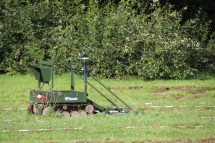
- services for carrying out hyperspectral aerial surveys;
- services for carrying out aerial surveys for supporting rapid reaction after the accidental explosion of an ammunition depot;
- an operational system for the analytical assessment of SHAs, aerial data acquisition and data fusion for supporting decision-making on SHA status and re-delineation.
The video gives an overview of these geospatial tools, services and guidelines to the Mine Action community. It ends with a presentation of the on-line catalogue that was designed to help Mine Action stakeholders make an informed choice of these products for their applications.
The video can be found here.
TIRAMISU partners involved: IGEAT (Leader), CTDT, DLR, EUSC, FGUNIZ, NOVELTIS, PLUS, RMA (Contributors).