TIRAMISU Partners map landmines in the Svilaja and the Dinara mountains, Croatia.
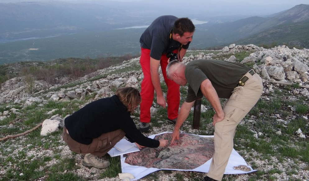
The TIRAMISU project funded by the European Commission under the Seventh Framework Programme (FP7) is researching methods and developing technologies to undertake non-technical surveys of suspected hazardous areas, using remote-sensing techniques. Members of the TIRAMISU consortium visited the Svilaja mountain near Peru?a, Croatia on the 4th of May, 2013 aiming to learn about the terrain of the former battlefield and to search for indicators to enable them to assess the extent to which the area remains infested with mines. The goal was to establish a key for interpreting airborne and satellite images so that indicators of the presence of mines on the site could be identified using Earth Observation technologies.
The team of scientists included Sabine Vanhuysse and Alix Sotiaux from the Université libre de Bruxelles (ULB), Tomislav Cvetko from CROMAC (survey officer, author of special requests for Svilaja mountain, team leader), Ivan Racetin (student, Faculty of Geodesy, Zagreb University) and Dr. Milan Baji? from HCR-CTRO. After familiarising himself with the terrain and gathering reference data, Tomislav Cvetko described the spatial-temporal changes that had taken place at Svilaja between 1991 and 1995. Similar activity was undertaken on the 4th of May 2013 at the foot of the nearby Dinara Mountain, by a group led by Tomislav Cvetko, and on the 5th of May 2013 on the eastern side of Svilaja.
The latest WorldView 2 images were taken on the 25th of April 2013, showing a panchromatic surface with 0.5 m resolution, in eight spectral channels and were used to support the activities of the group. After the acquired data had been gathered, contextual information (spatial and temporal history of the site) and expert knowledge (on the methods used to deploy mines) was considered. The team discussed the specific requirements as defined by CROMAC, with regard to the difference between the existing data and the data that was still required to provide them with a comprehensive overview of the dangers of the site.
The results of the investigations conducted at the Svilaja and the Dinara Mountains were presented by Tomislav Cvetko after they had been finalised. M. Baji? presented a full overview of the requirements for similar research in other areas of Croatia, and requirements, methods and resources for operational validation of the results of these investigations. Similar activities have since been planned for other suspected hazardous areas in the country.
Source: http://www.ctro.hr/eng/menu/news/article/field-investigation-of-the-battlefield-on-the-svilaja-mountain-and-on-the-foot-of-the-dinara-mountain-near-peruca-for-the-purpose-of-the-fp7-tiramisu-328.html